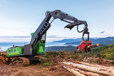
John Deere will now offer TimberMatic™ Maps and TimberManager™ as a standard offering for tracked harvesters or forestry swing machines with a factory-installed Waratah H-16 Measuring System.
This will enable the onboard TimberMatic™ Maps and cloud-based TimberManager™ programs to incorporate production data from the Waratah H-16 Measuring System.
The expanded software collects timber processing data from the H-16 system, providing a real-time look at job site progress.
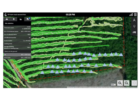
Increasing job site visibility and visualization, John Deere expands its TimberMatic™ Maps and TimberManager™ software to seamlessly incorporate data from the Waratah H-16 Measuring System. With the new capability, the TimberMatic Maps system collects production data from harvesting heads equipped with the Waratah H-16 system, providing real-time production data of processed timber linked to location through the in-cab monitor and synched to the cloud-based TimberManager. Job site progress data is then accessible to off-site managers or employees through a phone, tablet or computer using the TimberManager software.
The software pairing is available for John Deere tracked harvesters or forestry swing machines equipped with harvesting heads using the Waratah H-16 Measuring System. Additionally, the TimberMatic Maps and TimberManager are included in-base on new machines ordered with a factory H-16 Measuring System. A retrofit option can be downloaded and installed at no additional charge on existing machines utilizing the H-16 system. Machines must be equipped with 4G MTG and an active JDLink™ Telematics subscription.
“With this action, we are bringing together the powerful data collection capabilities of TimberMatic Maps and the Waratah H-16 Measuring System to offer more value to our customers,” said Matt Flood, product manager, John Deere. “Many of the challenges our customers face can be improved through increased visualization of job site workflow and productivity, and communication — seeing what is actually going on. With this expanding offering, we are providing more ways for our customers to collect data and analyze their business, helping them increase outputs and boost profitability.”
Launched in 2018, TimberMatic Maps and TimberManager enhance machine connectivity and communication. The TimberMatic Maps solution features mapping software for use in the field, leveraging a mobile network to share real-time production data between operators and office managers in the office. Data is collected through sensors on the equipment, while production location is gathered through GPS technology. This data is then shared to the cloud, where managers can access TimberManager from a PC, tablet or phone, allowing them to track job site progress remotely.


